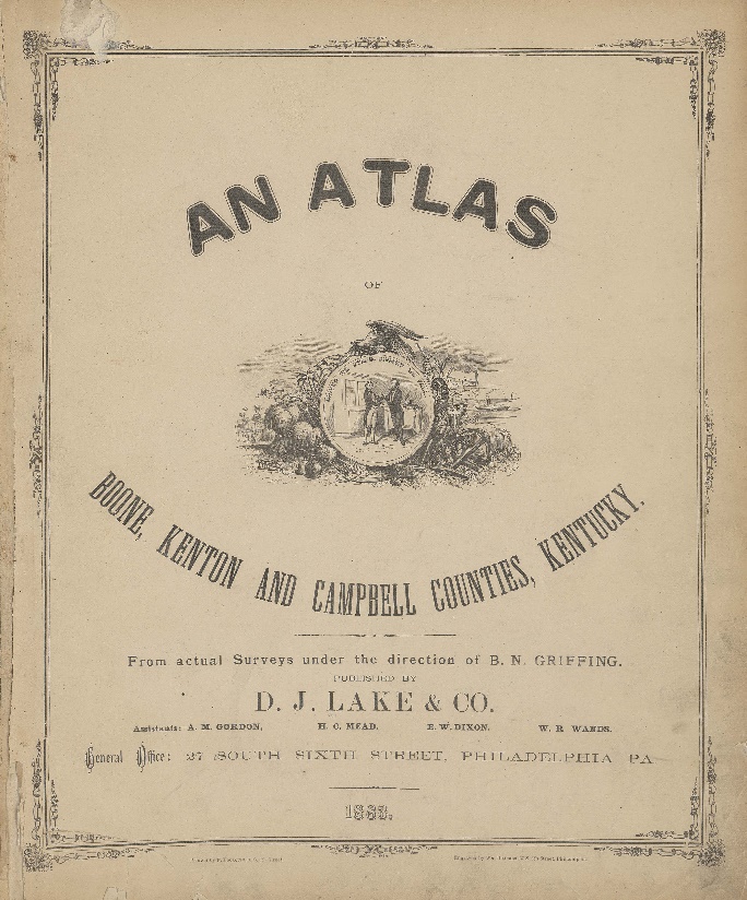
Atlas of Boone, Kenton and Campbell Counties, Kentucky; An
Item
-
Title
-
Atlas of Boone, Kenton and Campbell Counties, Kentucky; An
-
Creator
-
Griffing, B. N., project director
-
Publisher
-
D.J. Lake and Company
-
Place
-
Philadelphia, PA
-
Date
-
1883
-
Language
-
English
-
Temporal coverage
-
1880
-
Description
-
Compiled from actual surveys under the direction of B.N. Griffing. Includes business directories and United States population statistics by counties according to the 1870 and 1880 censuses
-
Accessed at Boone County Public Library, Burlington, KY
Linked resources
Items with "Source: Atlas of Boone, Kenton and Campbell Counties, Kentucky; An"
| Title |
Class |
| East Bend (Ky.) |
Location
|
| Elizabeth Utz Cemetery (Boone County, Ky.) |
Location
|
| First Baptist Church of Burlington (Burlington, Ky.) |
Organization
|
| First Baptist Church of Florence (Florence, Ky.) |
Organization
|
 Florence (Ky.) Florence (Ky.) |
Location
|
 Florence Precinct (Boone County, Ky.) Florence Precinct (Boone County, Ky.) |
Location
|
| Francisville (Ky.) |
Location
|
| Garrison Creek (Boone County, Ky. : Town) |
Location
|
| Gasburg (Ky.) |
Location
|
| Grimsley Cemetery (Boone County, Ky.) |
Location
|
| Hamilton (Ky.) |
Location
|
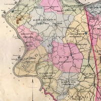 Hamilton Precinct (Boone County, Ky.) Hamilton Precinct (Boone County, Ky.) |
Location
|
| Hathaway (Ky.) |
Location
|
 Hebron (Ky.) Hebron (Ky.) |
Location
|
| Hebron Lutheran Church (Hebron, Ky.) |
Organization
|
| Hopeful Heights (Florence, Ky.) |
Location
|
| Huey's Corners (Ky.) |
Location
|
| Hughes Chapel Cemetery (Beaver Lick, Ky.) |
Location
|
| Hume (Ky.) |
Location
|
| Idlewild (Ky.) |
Location
|
| Kensington (Ky.) |
Location
|
 Limaburg (Ky.) Limaburg (Ky.) |
Location
|
| Marshall-Bradford Cemetery (Boone County, Ky.) |
Location
|
| Marydale (Ky.) |
Location
|
| McVille (Ky.) |
Location
|