Adams-Riley Cemetery (Boone County, Ky.)
Item
-
Title
-
Adams-Riley Cemetery (Boone County, Ky.)
-
Description
-
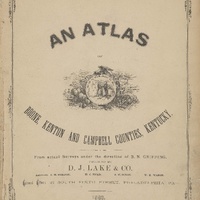
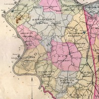
This is a family cemetery measuring 60 x 60 feet, and containing more than 20 internments. Burials range from 1841-1870. The cemetery was vandalized at one point. It is located off Hathaway Road, due north of 2444 Hathaway and west of 9835 Spruce Dr. The cemetery is in a one of a number of heavily overgrown wooded areas that run along the eastern side of the 108-acre Kenkel property. It is about 1500 north of Hathaway Road and 500 feet west of Spruce Dr. At the time of the site visit, the property was under consideration for residential development. Cemetery mapped and delineated by an archaeologist on November, 2007. All of the legible markers listed above appear to have been intentionally broken and are, at best, fragmentary. Most of them are located in a small area where it appears they dragged and then broken. It is unlikely that any of them are in situ. The broken Louisa Adams marker may be close to its original location. In addition, there are other in situ fieldstone and finished stone markers scattered across the area, which measures about 45 by 50 feet. While there are no Adams located in this area on the 1883 Atlas, the Riley family owned property immediately to the west, including what is now recorded in the National Register as the Blankenbeker-Riley Farm, built 1913.
-
Slave holder or African American Burials: No
-
Has beginning
-
1841
-
Has end
-
1870
-
Identifier
-
Boone Co. GIS Cemetery ID: 203
-
Find A Grave Cemetery: #2409211
-
Full address
-
9854 Spruce Lane, Union, KY 41091
-
Located within
-
Ballyshannon (Boone County, Ky. : Subdivision)
-
Latitude
-
38.94821293000
-
Longitude
-
-84.70204440000
-
Target coordinates
-
699140.288 m
-
4313540.839 m
Linked resources
Items with "Related resource: Adams-Riley Cemetery (Boone County, Ky.)"
| Title |
Class |
| Adams family |
Organization
|
| Riley family |
Organization
|
 Union Precinct (Boone County, Ky.)