-
North Bend Region (Boone County, Ky.)
The North Bend area was the first to be settled in Boone County. It refers to the northern bend of the Ohio River. It should not be confused with North Bend, Ohio located nearby in the Greater Cincinnati region.
-
 Big Bone Region (Boone County, Ky.)
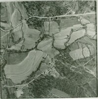
 Big Bone, Kentucky, is an area in southern Boone County. It is bounded on the west by the Ohio River, and Rabbit Hash, on the south by Big Bone Creek, which empties into the river at Big Bone Landing. The northern extent is along Hathaway Road, and the eastern portion extends not further than U.S. 42, and is approached from that direction by Beaver Road (Route 338) coming from either Richwood or Walton. Geographical features of interest include the now disappeared Big Bone Island and the Palisades of Big Bone Creek. The most notable feature is the famous Big Bone Lick, now the site of a state park. The name Big Bone also applies to the area of several thousand acres surrounding the Lick. The area is rained by Big Bone Creek, Gunpowder Creek and by Mud Lick Creek.
-
Big Bone Salt Springs (Boone County, Ky.)
The most famous landmark of the Big Bone area, it is now the site of a state park. The salt lick, or lick, as it is more generally known here, was long known to the original inhabitants of the area. It was discovered by people of European descent about 1735, the first recorded instance being one Robert Smith, an Indian trader.
-
 Big Bone Island (Ky.)
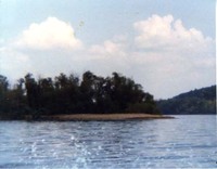
 Big Bone Island was located in the middle of the Ohio River at the mouth of Big Bone Creek. It was just over the county line into neighboring Gallatin County, Kentucky. (The county line runs down the center of the creek.)
-
 Laughery Island (Ky.)
-
Big Bone Landing (Ky.)
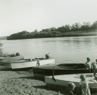
Big Bone Landing is the spot where Big Bone Creek empties into the Ohio River.